FOB - A Watershed Improvement Association
  • Home
  • About
    • News Releases
    • Who We Are
    • About the Bohemia River and watershed
    • Historical Markers in the Watershed
    • What Can You Do to Improve our Watershed?
    • Water Quality Report Card
    • Photo Gallery
  • Donate/Join
  • Contact Us
  • Partners
  • Home
  • About
    • News Releases
    • Who We Are
    • About the Bohemia River and watershed
    • Historical Markers in the Watershed
    • What Can You Do to Improve our Watershed?
    • Water Quality Report Card
    • Photo Gallery
  • Donate/Join
  • Contact Us
  • Partners

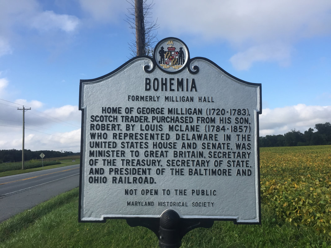
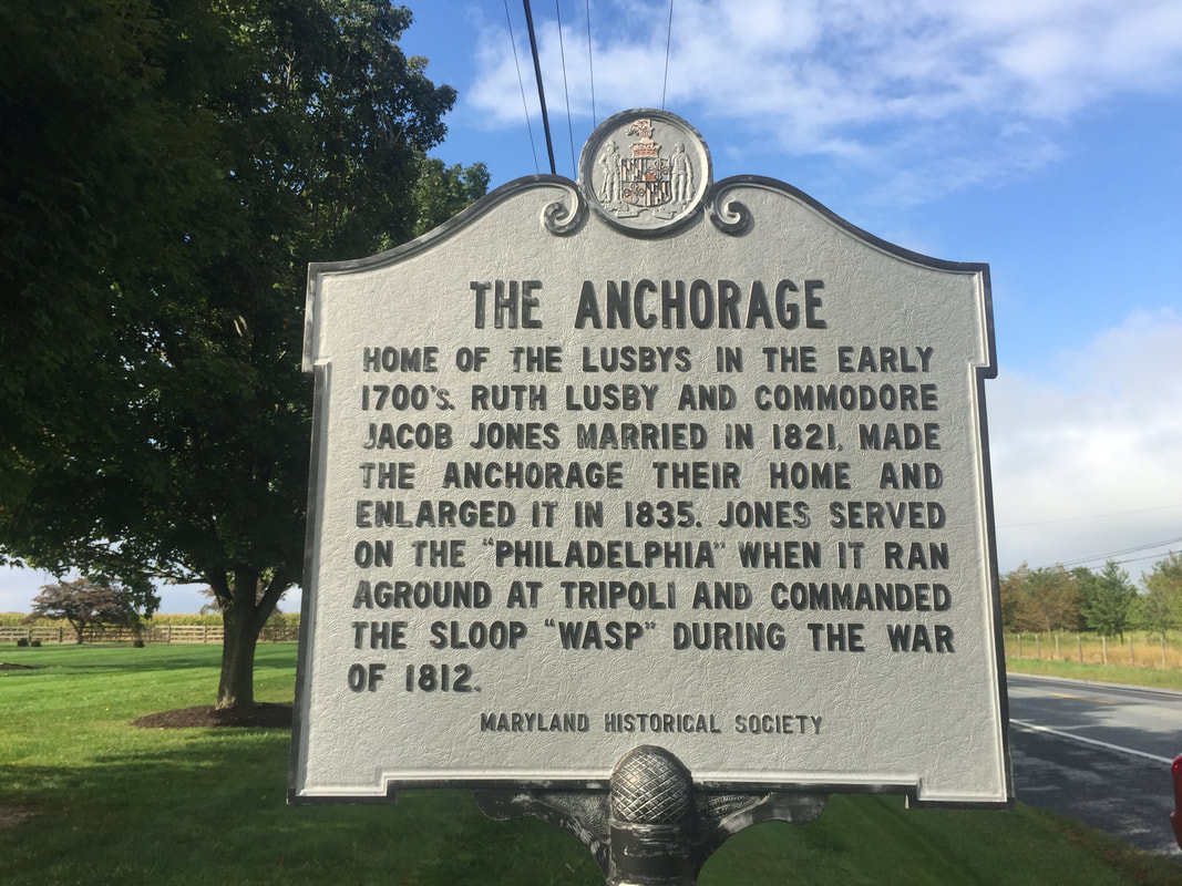
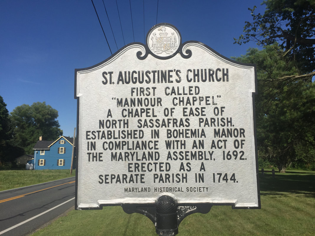
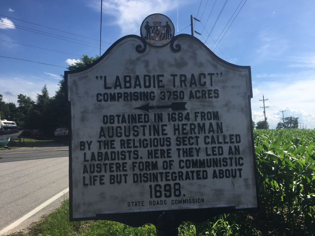
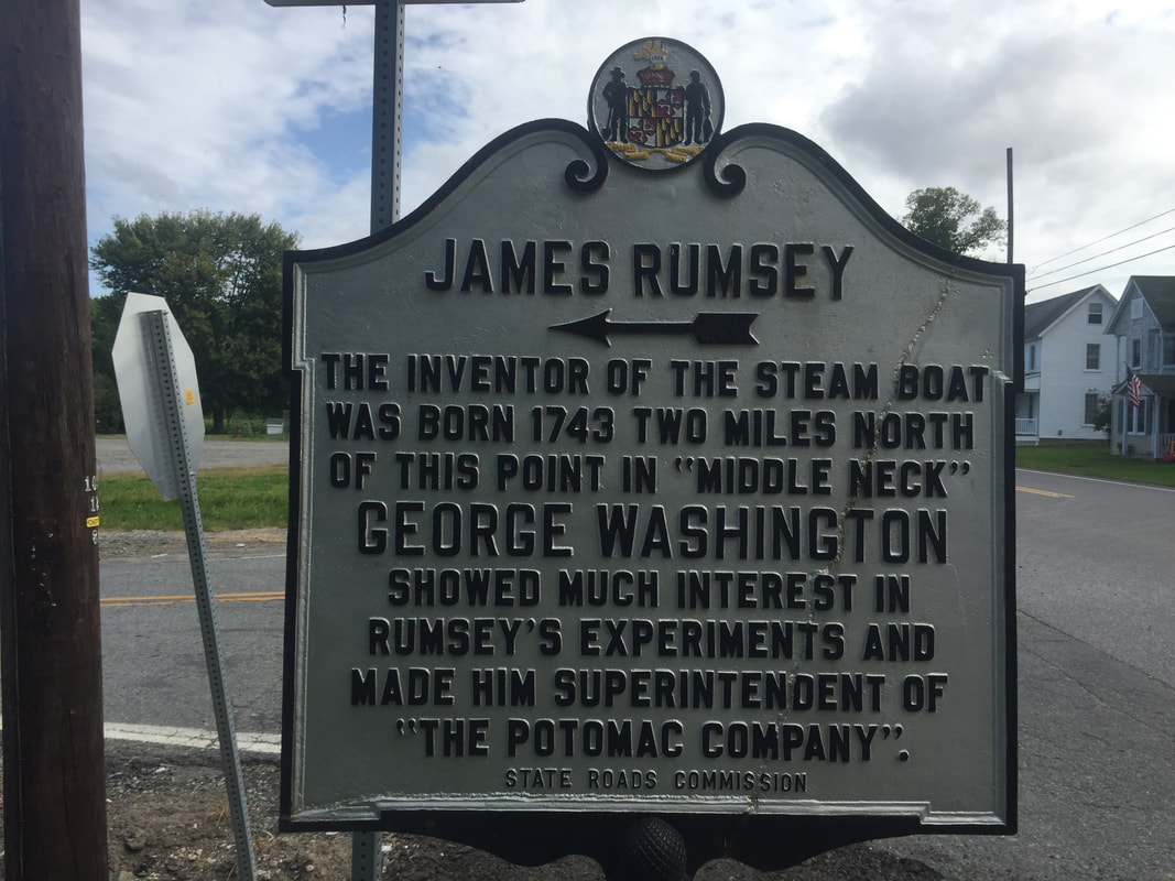
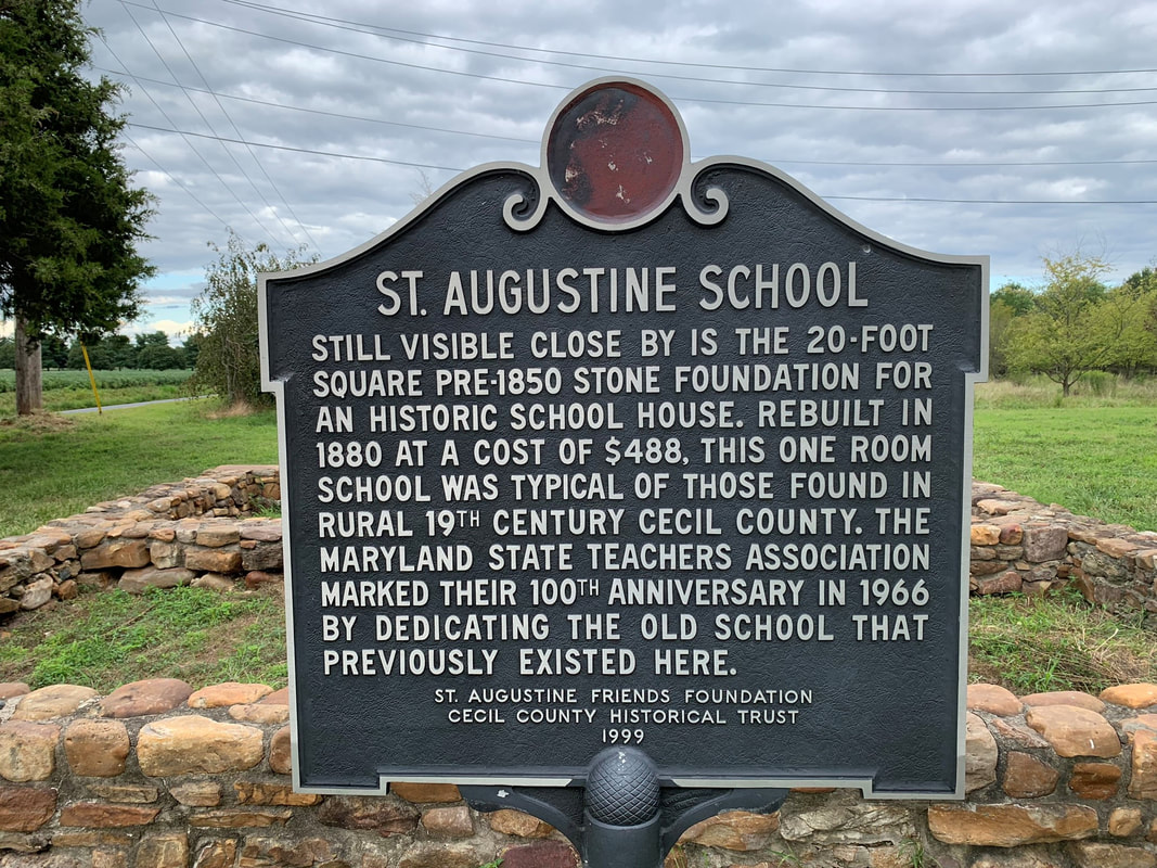
HISTORICAL MARKERS IN THE BOHEMIA WATERSHED

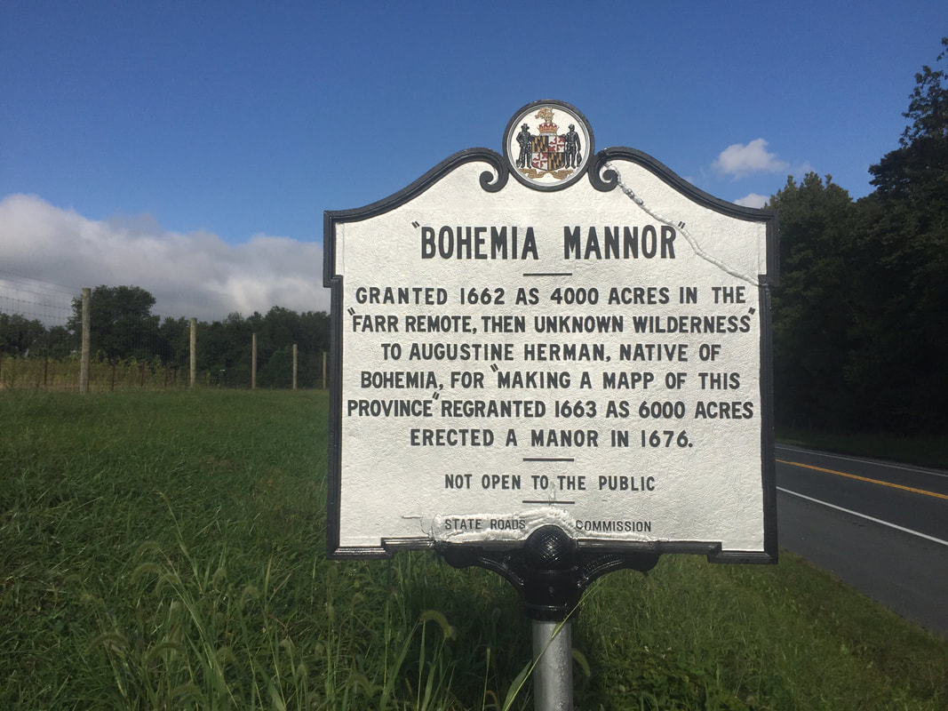
Our community has an amazing story!  Here are some historical markers you can find along the roadways in the Bohemia River Watershed.  Here also is a picture of Augustine Herman's 1670 map of the Chesapeake Bay (courtesy of the Maryland Historical Archives).  As part of his compensation for making the map, Augustine was given his choice of a parcel of land.  After seeing the entire Bay, he picked what he considered to be the best, most beautiful land...our watershed..and named it "Bohemia" after his homeland in eastern Europe.  
Picture
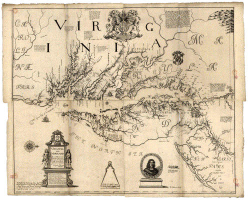
Courtesy Maryland Historical Archives
Friends of the Bohemia, Inc.
PO Box 506, Chesapeake City, MD 21915
(443) 566-3513     |     [email protected]
© 2017 - 2024 Friends of the Bohemia, Inc. All rights reserved